![]()
From The Conversation (5/8/24)…
Antarctic heat, wild Australian winter: what’s happening to the weather and what it means for the rest of the year
Australia’s south and east have seen freezing temperatures and wild weather this winter. At the same time, the continent as a whole – and the globe – have continued to warm.
What’s going on? As ever, it’s hard to pinpoint a single cause for weather events. But a key player is likely an event unfolding high above Antarctica, which itself may have been triggered by a heatwave at surface level on the frozen continent.
Here’s what’s happening – and what it might mean for the rest of this year’s weather.
When the stratosphere heats up
Our story begins in the cold air over Antarctica. July temperatures in the stratosphere, the layer of air stretching between altitudes of around 10 and 50 kilometres, are typically around –80°C.
The winds are also very strong, averaging about 300 kilometres per hour in winter. These cold, fast winds loop around above the pole in what is called the stratospheric polar vortex.
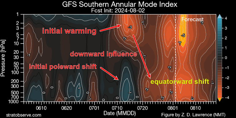
Occasionally, persistent high air pressure in the lower atmosphere can influence large-scale waves that extend around the globe and up into the stratosphere. There they cause the strong winds to slow down, and the air high above the pole to become much warmer than normal.
In extreme situations the stratospheric winds can completely break down, in what is called a “sudden stratospheric warming” event. These events occur every few years in the northern hemisphere, but only one has ever been observed in the south, in 2002 (though another almost happened in 2019).


